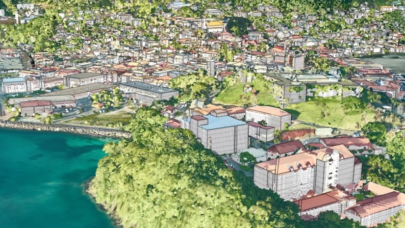
Grenada, a nation small in both size and population, recently recorded a monumental achievement. In 2021, the country became the first to make a digital copy of itself, a 3D model government officials can use for sustainability plans.
Like many island nations, Grenada is confronting an uncertain future in the face of climate change. Increasing heat, intense rainfall, and saltwater intrusion into the water supply and soil have begun to threaten the country’s two primary economies—agriculture and tourism. One key challenge was how to continue to grow in a sustainable way and adapt to the changing environment. This would require a geographic approach—understanding what was happening, where.
Grenada’s government had stores of raw geospatial data in the office of the Ministry of Agriculture and Lands. In 2019, the office had received World Bank funds through the Regional Disaster Vulnerability Reduction Project and hired Fugro, a company that specializes in geographic and geological data-gathering and analysis, to do extensive aerial reconnaissance of Grenada.
Fugro surveyed the Caribbean nation’s three major islands, as well as six smaller ones. The result was a treasure trove of information, including a lidar point cloud and extensive aerial images. But for practical purposes, it was more like treasure without the trove. In short, there appeared to be no way to organize all this valuable information, until the ministry decided to use geographic information system (GIS) technology to create a digital twin.